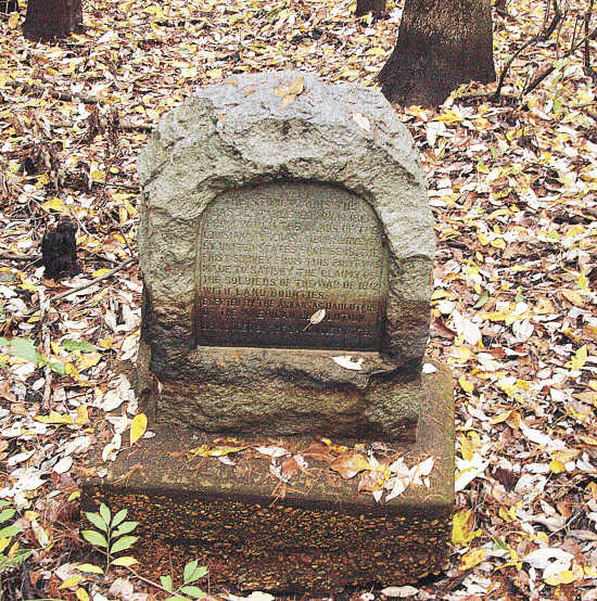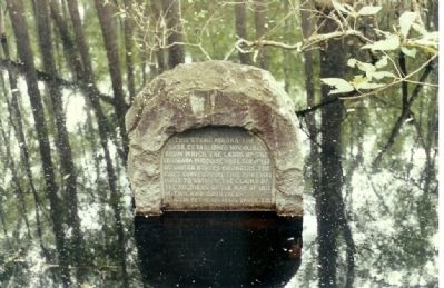
This stone marks the base established Nov.10,1815 from which the lands of the Louisiana Purchase were surveyed by the United States Engineers. The first survey from this point was made to satisfy the claims of the soldiers of the war of 1812 with land boundries.
Erected 1926 by Arkansas Daughters of the American Revolution.

In 2005 , the Great State of Arkansas officially recognized the American Creole Indian Nation, by way of the Arkansas Department of Education as a "Protected Ethnic Class", ethnically unique unto themselves & their unique historic culture that pre-dates USA acquisition.
This obscure marker located in Monroe, Arkansas, USA (Arkansas State Park) is a place of great mourning to the American Creole Indian.

This obscure marker in The Great Creole Indian Territory of Monroe, Arkansas, USA represents the beginning of the end of the official territorial existence of my people as recognized by the Federal United States Government, in violation of it's own LPT 1803 Treaty.
Louisiana Purchase State Park
Are you interested in the history of the Louisiana Purchase? This National Historic Landmark at the junction of Lee, Monroe and Phillips counties preserves the initial point from which all surveys of the property acquired through the Louisiana Purchase of 1803 initiated. That year, President Thomas Jefferson purchased the vast territory of Louisiana from France for $15 million. The unmapped wilderness of approximately 900,000 square miles doubled the size of the fledgling nation and helped shape the destiny of the United States.
Twelve years later, President James Madison ordered an official survey of the purchase area, a survey that began in what is now Arkansas and led to the settlement of the American West.
Both meridian and the baseline would later be extended, and land surveys for all or parts of the Louisiana Purchase states west of the Mississippi would subsequently be measured from this initial point in eastern Arkansas. From this point emanated the surveys for Arkansas, Missouri, Iowa, Minnesota, North Dakota and part of South Dakota.
To see the granite monument that marks the site of the initial point, you'll walk along an elevated boardwalk above the headwater swamp in which the monument is located. The L’Anguille Chapter of the National Society Daughters of the American Revolution in Marianna placed the marker at the initial point in 1926 following the discovery by two surveyors, in 1921, of the gum trees that were marked by the initial surveyors back in 1815. That discovery focused attention on the site located at the junction of Lee, Monroe and Phillips counties in a headwater swamp in the Little Cypress Creek watershed that had gone unheralded for more than a century. The Arkansas General Assembly passed legislation in 1961 designating the area an Arkansas state park.
As you walk along the boardwalk, you'll experience the captivating beauty and natural sounds of the surrounding swamp. Along the boardwalk, interpretive wayside exhibits tell about the Louisiana Purchase and describe the flora and fauna of the swamp. This headwater swamp is representative of the swamplands that were common in eastern Arkansas before the vast bottomlands were drained and cleared for farming and commercial purposes.
Louisiana Purchase State Park is located south of Brinkley. From I-40 at Brinkley, take U.S. 49 and travel 21 miles south, then go two miles east on Ark. 362 to the park.
The park is open from 6 a.m. until 9 p.m. daily.
For more information about Arkansas State Parks historic, heritage and cultural parks, go to: http://www.historystateparks.com/
Contact Information
888-AT-PARKS
The Arkansas Department of Parks and Tourism is in compliance with the Freedom of Information, Ar. Code Ann., § 25-19-101 et seq.
© 2009 Arkansas Department of Parks and Tourism. All rights reserved.
http://www.historystateparks.com/
Contact Information
Email: louisianapurchase@arkansas.com
888-AT-PARKS
ArkansasStateParks.com
The Arkansas Department of Parks and Tourism is in compliance with the Freedom of Information, Ar. Code Ann., § 25-19-101 et seq.
© 2009 Arkansas Department of Parks and Tourism. All rights reserved.
document.
This marker is included in the National Historic Landmarks marker series. Location. 34° 38.838′ N, 91° 3.252′ W. Marker is in Holly Grove, Arkansas, in Monroe County. Marker is on Baseline Road (Arkansas Route 362). Click for map. At end of Baseline Road,a walk of 450 feet down boardwalk into the swamp,at Louisiana Purchase State Park. Located at the junction of Lee, Monroe and Phillips Counties. Marker is in this post office area: Holly Grove AR 72069, United States of America. Also see . . . 1. Beginning Point of the Louisiana Purchase Survey. (Submitted on March 8, 2008, by Mike Stroud of Bluffton, South Carolina.) 2. Are you interested in the history of the Louisiana Purchase. (Submitted on March 8, 2008, by Mike Stroud of Bluffton, South Carolina.) 3. Registry for National Landmark. data supplied (Submitted on March 8, 2008, by Mike Stroud of Bluffton, South Carolina.)

